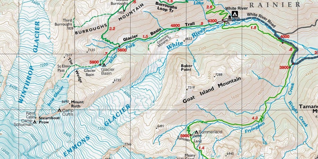
If you’ve spent any amount of time looking at a topographical map, you’ve probably noticed some lines that seem to completely random throughout the map. However, these lines serve an important purpose when it comes to knowing the trail and the area you’re hiking in. These lines are called contour lines and they show the elevation and topography in a given area. Knowing how to read these lines will help you improve your map reading skills and make you more aware of the area you’re hiking in.
Understanding Contour Lines
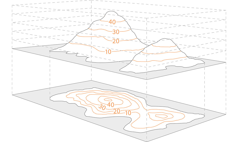
One of the biggest drawbacks to a map is the flatness. A map is 2-dimensional and generally cannot relay information in a 3-dimensional scale. The Earth is 3-dimensional with many peaks and valleys. So show this information, map creators drew these contour lines to help readers understand the terrain.
The most important thing about contour lines is how they show elevation. Each line is a different elevation. However, all the points along one line will be at the same elevation. Following the line means you will not change elevations. Crossing between lines means you will either be descending or ascending. The second piece of information they show is how steep the incline/decline is. The closer the lines, the steeper the slope. But, the question remains, how do you know the vertical change in elevation?
Understanding the Types of Lines
On a contour map, there will be three types of lines. The biggest and most noticeable is the index line. The index line is the thickest line and usually marked with a number through it. This number tells you the elevation above seal level. The second line type is intermediate lines. These lines occur between the contour lines. On a typical map there will be 5-8 intermediate lines for every index line. The third line is called a supplementary line. This line is usually a dotted line across flatter terrain.
So the question remains, how do you know the elevation between lines? If you look in the legend of the map, one section is called a contour index. This contour index tells the change in elevation between lines. For example, if a map has a contour index of 50, that means the vertical change in elevation between lines is 50ft (or meters depending on the units). Another way to describe is, each line is 50ft above or below the line adjacent to it.
Now that you know how these lines dictate elevation changes, see if you can figure out some of features of the landscape in the photo on the right.
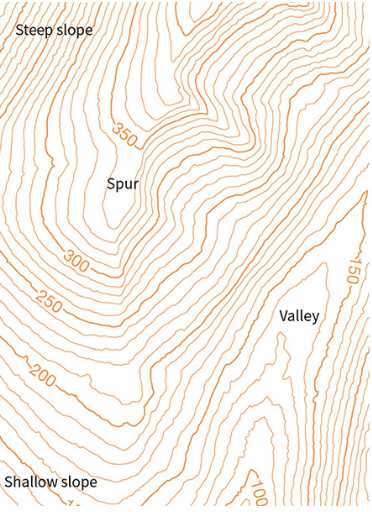
Using the image on the right, look in the upper left area. These lines are very close together. The closer the lines, the steeper the incline. Because the lines are closer, they show a great change in elevation over a very small area of land. Looking at the bottom left, you can see the lines are further apart. These lines show a shallow change in elevation. The lines are further apart, meaning the change in elevation occurs over a large distance.
Showing the Formations
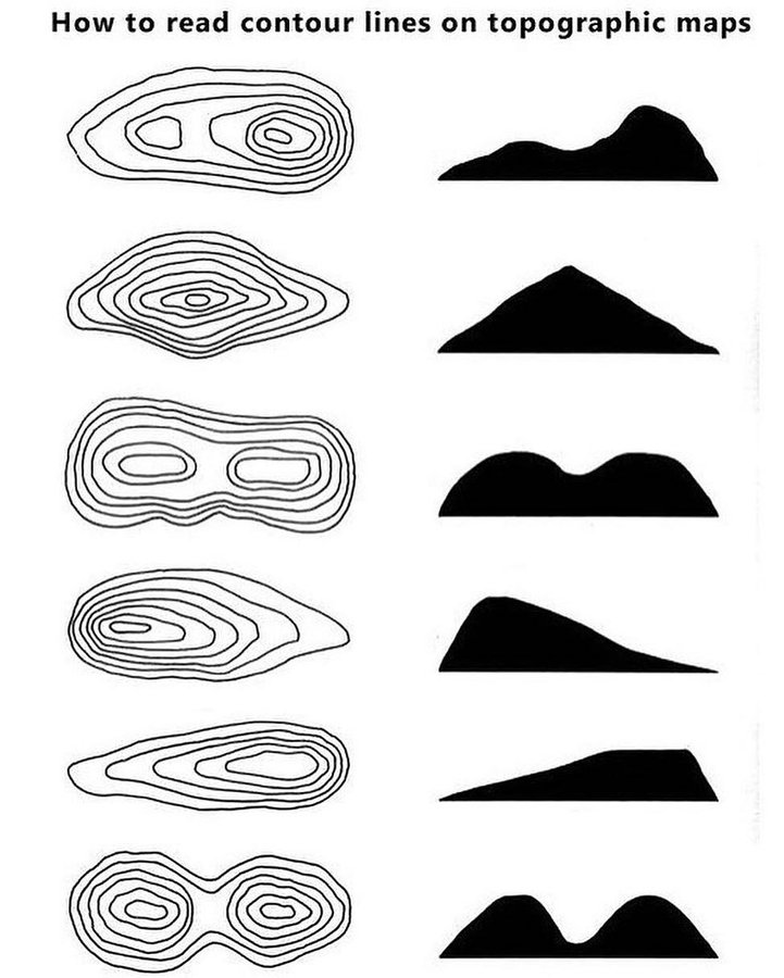
There are several types of formations all across Earth. Knowing how the lines on a map interact will help you understand the terrain. Contour lines coming to a point illustrate a valley (above picture). The lines show increasing elevation on each side. Some rivers will run through the valley. So if you are in need of a water refill, a valley could be a something to look for. Lines that are more rounded on one end coming to a point show a spur. Lines that appear to merge together show a cliff. On rare occasions, you will see lines with marks on one side. These marks indicate a depression instead of an incline. The marks will point inward towards the depression. In these areas you’ll also see elevation on the index lines decreasing.
Taking a 3D picture and placing it on a 2D surface while still providing some information to the hiker is a challenge. Understanding the formations can give you an edge on the trails. You will be able to find good places to rest before continuing up the side of a hill. Or you can find an alternate route to avoid a hill. Understanding contour lines is an important piece regarding navigation.
There are so many formations and it’s nearly impossible to describe the all or find all of them on one map. However, studying the map and knowing the basics and what to look for can make you better prepared for any outdoor trip. The better prepared you are, the less likely you’ll experience any issues or trouble on trail! As always, be safe and happy hiking!
